Geographic Information Systems
What is GIS?
Geographic Information Systems (GIS) are software tools designed to visualize and analyze spatial data, whether natural or man-made. These tools allow us to better understand the world around us and how we interact with it. The main use of this software is to create maps, both as interactive digital versions and physical prints. From Google Maps navigation to Doppler radar maps, nearly all the map products you use in your everyday life were created using a GIS.
GIS Data
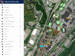
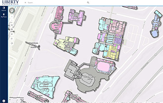
Facilities Management uses GIS to track the location of assets around campus as well as the values associated with those assets. GIS allows us to take data previously stored in static tables and transform that data into spatially aware features on a map. Some of our location data can be found in our interactive Campus Map.
Public Map Gallery
Resources for Liberty University Employees
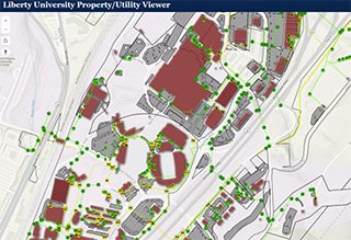
Internal Map Gallery – Credentialed Users
Accessing Outdoor Maps
Accessing Indoor Maps
Internal Map Access
Liberty University employees who need access to additional map data, whether through the ArcGIS Online or the internal ArcGIS Enterprise Portal – may request access or schedule training by emailing FMInformatics@liberty.edu.Contact
Troubleshooting
Liberty University employees accessing the Liberty University Enterprise GIS Portal while off campus will need to make sure they are connected to the Cisco Secure Client VPN and use the Liberty University single sign on when logging in.
Staff
Senior Geographic Information Systems Analyst
Jason Abdulla
Geographic Information Systems Technician
Jared Cico